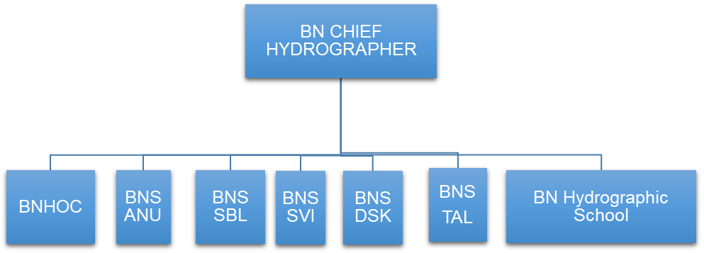
Organogram
Bangladesh Navy Hydrographic Department is headed by the BN Chief Hydrographer. The department comprises of five hydrographic survey ships, a hub of all hydrographic works namely Bangladesh Navy Hydrographic & Oceanographic Centre (BNHOC) and an international training establishment. The organogram is as follows:
Capability
Bangladesh Navy Hydrographic Department is capable of conducting modern hydrographic surveys. It also conducts topographic and oceanographic surveys as well. The department possesses a good number of modern hydrographic, topographic and oceanographic instruments in its inventory. Multibeam Echosounder (MBES), Single Beam Echosounder (SBES), Side Scan Sonar (SSS), Sub Bottom Profiler, LiDAR are some of the significantly mentionable modern survey equipment of the department. The surveys are conducted by experienced and qualified officers and survey recorders who all are trained from home and abroad. The department is also capable of producing International Hydrographic Organization (IHO) standard Paper Charts and Electronic Navigational Charts (ENC). Moreover, the acquisition of Uncrewed Surface Vessel (USV) and Unmanned Aerial Vehicle (UAV) is in progress, which will enhance the modern surveying capability of the department.
Training and Capacity Building
Bangladesh Navy Hydrographic School, a leading institution in the hydrography sector of the country, conducts courses on hydrographic surveying for the BN officers and sailors. The school is accredited by IHO to conduct Category B Hydrographic Course where officers from different national maritime organizations and friendly foreign navies also participate every year. Moreover, BNHOC also conducts training on marine cartography and relevant fields for the BN officers and sailors for the production of paper charts and ENCs.